App: A bike map and guide for Chicagoland
Consider this: You like to use the Chicago Bike Map but you don't always carry it with you. You want to be reminded of where the bike lanes and trail access points are. But you do carry your smartphone with you, all the time.
In April 2012 I launched my first-ever app, the Chicago Bike Guide. It works similarly to the "Chicago Bike Map" (the City's printed one) in that it shows the presence of on-street bike lanes, multi-use trails, and train stations. It works like Google Maps, though, where you can pinch and zoom to interact with the map.
Divvy, train stations, directions, The Chainlink, Twitter, points of interest, it's all right here.
Available for Android and iOS.
Views: 3935
Replies to This Discussion
-
Permalink Reply by Steven Vance on
-
Oh yeah, I know the co-creator of that project. I'll be posting the interview later today, but here's a preview article on Grid Chicago.
Thank you to everyone who's purchased the app so far. I started working on the Android version last night (it looks to be just as complicated as the iOS version, but in very different ways). I also uploaded an update yesterday that fixes bugs and brings the bike lanes up-to-date (Elston is now completed on the map, and 55th Street is shown as a buffered and protected bike lane from Cottage Grove to Lake Park). It may take a week for Apple to approve the update (ugh).
Julie Hochstadter said:
Gapers block featured a new CTA app that is empowering others to help with the research and is using kickstarter to find them and fund the work at the same time. - http://gapersblock.com/ac/2012/07/09/designers-kickstarting-a-cta-a...
-
Permalink Reply by Dan Dorfman on
-
This is terrific. I've tried using Google Maps for biking & it's just wrong too often to be useful. Also looking forward to Android version. This will be the first paid app I will be downloading, but at $.99 it's more than a bargain. Thanks, Steven, for doing this.
-
Permalink Reply by Far'arned Retrogrumpalunkus #63 on
-
The biggest issue I have with Google Maps is the fact that they tend to be ridiculous when it comes to routing. It will not let you go even 10-feet worth of contra-flow on a 1-way street and this really makes some routing very difficult. I've resorted to just writing down loose instructions on paper with one of those old-fashioned hand writing implements as it is just easier much of the time.
-
-
I just downloaded this today and it's a great app! Thanks for designing it.
One thing I noticed, since this is part of my commute - you can extend the bike lane on Wells from Wacker south into the loop. Currently the app shows that bike lane terminating at Wacker coming from the north.
-
-
The main "feature" of my app is that you don't need the internet to use it. That was one of the motivating factors in making the app: I don't have a data plan on my iPhone. The second motivating factor in making the app is that the printed bike map (and CDOT's online version of it) show "recommended routes" and "marked shared lanes". I don't like these; they are not facilities. There's a documented difference in the safety of streets with bike lanes and streets without (a lot of the difference has to do with the increased presence of cycling on streets with the bike lanes).
I created a map that only shows places where you get a bike lane, stripes on both sides (plus trails, where cars can't be driven). And the color scheme was chosen so that the more dark green there is on a line, the safer it's presumed to be:
- Bike lanes are light green
- Buffered bike lanes are light green with dashed dark green outline
- Protected bike lanes are light green with solid dark green outline
- Trails are dark green
I started Android development last night. There's a hard road ahead in developing that. It has different difficulties compared to iOS development meaning I'll have to learn a whole new way of developing apps.
v0.3 is awaiting iTunes Store approval (bug fixes, updated map).
James BlackHeron said:The biggest issue I have with Google Maps is the fact that they tend to be ridiculous when it comes to routing. It will not let you go even 10-feet worth of contra-flow on a 1-way street and this really makes some routing very difficult. I've resorted to just writing down loose instructions on paper with one of those old-fashioned hand writing implements as it is just easier much of the time.
-
-
I agree. The "marked shared lanes" are a particularly bad joke. The Wells Street lane under the L tracks takes up most of the west lane & the cars pay no attention whatsoever. The "recommended routes" are not much better, with their little snippets of bike lanes that start & taper off mid-block. Sometimes, though, as a commuter, I have little choice.
Steven Vance said:The main "feature" of my app is that you don't need the internet to use it. That was one of the motivating factors in making the app: I don't have a data plan on my iPhone. The second motivating factor in making the app is that the printed bike map (and CDOT's online version of it) show "recommended routes" and "marked shared lanes". I don't like these; they are not facilities. There's a documented difference in the safety of streets with bike lanes and streets without (a lot of the difference has to do with the increased presence of cycling on streets with the bike lanes).
I created a map that only shows places where you get a bike lane, stripes on both sides (plus trails, where cars can't be driven). And the color scheme was chosen so that the more dark green there is on a line, the safer it's presumed to be:
- Bike lanes are light green
- Buffered bike lanes are light green with dashed dark green outline
- Protected bike lanes are light green with solid dark green outline
- Trails are dark green
I started Android development last night. There's a hard road ahead in developing that. It has different difficulties compared to iOS development meaning I'll have to learn a whole new way of developing apps.
v0.3 is awaiting iTunes Store approval (bug fixes, updated map).
James BlackHeron said:The biggest issue I have with Google Maps is the fact that they tend to be ridiculous when it comes to routing. It will not let you go even 10-feet worth of contra-flow on a 1-way street and this really makes some routing very difficult. I've resorted to just writing down loose instructions on paper with one of those old-fashioned hand writing implements as it is just easier much of the time.
-
-
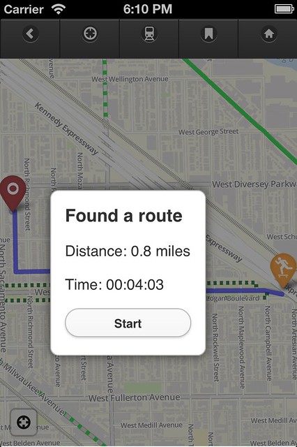
I forgot to add that another feature is the lack of routing. I can't do it without internet, plus I didn't want to give people another routing app/software. This is designed for people who respect the map, know how to read it, but want a slightly different map. For people who want to design their own route but just need to know which streets do/don't have bike lanes.
-
-
The app is free today, Sunday.
http://www.offlinebikemap.com/2012/the-chicago-offline-bike-map-wil...
-
-
Thank you, Howard.
The app is supposed to hold your currently viewed location when hitting the "toggle transit" button (the one that looks like the front of a train). I just tested it on my iPhone now.
Can you tell me which version of iOS you are using?
h' said:Relative handheld virgin here-- just put it on my Touch. Very nice. The stolen bike info is great.
Would be cool if it held your currently viewed location when hitting the button to show transit.
Good work!
-
-
Ah. That button is supposed to zoom you to downtown. The icon is supposed to be a skyscraper, and the button takes you back to the Loop (the default location when you open the map). The purpose of this is to take you back to a place on the map where you can "start over" your browsing from a known location.
h' said:Sorry, it's not the little train toggle that knocks you back downtown but the one to the right of it that looks like the "bird" sign. iOS 5.1.1.
-
Permalink Reply by Tom Kompare on
-
Nice work, Steve!
This is a great on-the-spot resource when there is poor or no internet connection available.
-
-
Thanks. The "no data connection" features will never go away!
BTW, 124 people downloaded the app during "free day", only 93 of them from the United States market.
Tom Kompare said:Nice work, Steve!
This is a great on-the-spot resource when there is poor or no internet connection available.
Groups
-
Chicagoland Beer Explora…
203 members
-
Wednesday Night for Mort…
1 member
-
Great Lakes Ultra Cycling
270 members
-

Major Taylor Internation…
1 member
-
Critical Mass discussion
261 members
© 2008-2016 The Chainlink Community, L.L.C.
Powered by
![]()